Sunday. May 8, 2016.
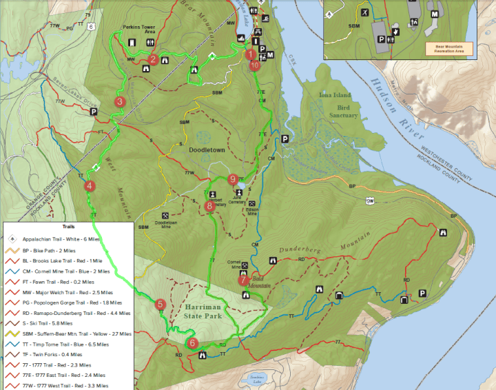
15+ miles covered exploring the Bear Mountain trails. Ok – I didn’t really plan to cover this distance. It just happened because I kept on intentionally making myself lost in the trails. This was my first time exploring these trails and I only had the Avenza PDF Map App as my guide, which served me well. The plan was to go back to Bear Mountain and re-trace the trail leading back to Timp Pass, the last steep climb in the TNF ECS BM event I did on April 30th. I wanted to have a picture of that climb, then and now. ‘Then’ – but my smartphone died; ‘Now’ – with fresh legs and a point-and-shoot camera.

I parked at the Bear Mountain Inn ($10 parking fee). With my backpack loaded with 4 water bottles (2 with my tailwind+carbopro mix), a bar, some nuts, and my-supposedly-tuna-wrap-lunch, off I started the trek around 12NN. I went to the trail head at the back of the Inn, south-end of Hessian Lake, and followed the White trail (AT-Appalachian Trail). It was a long stretch of stone steps going up. I didn’t know where these steps lead to – I just kept going. At some point, there was a sign that says ‘To Inn’ and ‘To Tower’. I was not going back to the Inn yet, and Tower? ‘What Tower?’. So I just followed the sign going up to the Tower. More climbing and then there it was – the ‘Tower’. It turned out to be the Perkins Memorial Tower. This is our summit stop when doing our Bear Mountain bike rides!!! This time, I appreciated the scenic views, and took pictures.
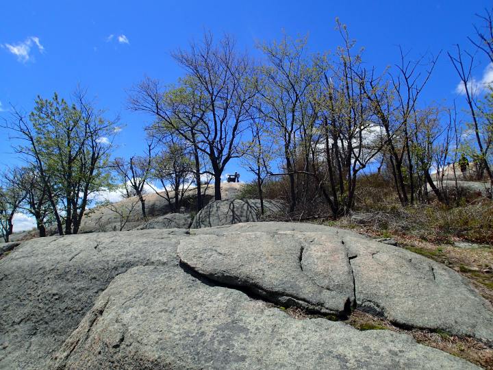

‘Where to next?’. I looked at my digital map. I could re-trace the trail back to the Inn, or keep following the White trail south going to the West Mountain section, one sign says. ‘What’s in the West Mountain section?’. So I continued to follow the White trail. The trail from Perkins was a descent, some steep, some runnable. My backpack was not designed for active running when loaded. I was grasping the straps when running and hopping on the trail to minimize the bounce. Still on the White trail, I crossed the Seven Lakes Drive road, back to the woods, and started climbing again, intersecting with the Red (77W) trail briefly, back to White, until the White/Blue (AT/TT-Timp Torne) trail. This would lead to the West Mountain vantage point. The end of White/Blue trail would be another good vantage point.
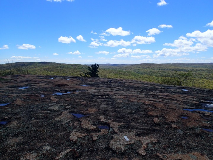

‘Where to next? White goes there, Blue goes there… Hmmm, I’m lucky with White. Keep going White’. It was a rocky descent. After the descent, I looked at my map – this section was not in the map and/or covered by the map legend. ‘I think I’m going the wrong way’. Saw 2 hikers and asked. ‘Yup, you need to go back’. Hiked back up that rocky section, until I was back at the vantage point in the White/Blue trail. ‘Ok, let’s follow the Blue trail this time’. The Blue trail intersects with the Yellow (Suffern-BM) trail – which leads back to Bear Mountain area. I kept on following the Blue trail. There was a shelter on the Blue trail – which I found out later, after Google search, is the West Mountain Shelter. There was a guy with a tent – either he has already spent the night, or planning to. I stopped and asked a few questions. He said it’s ok to stay overnight in the area, no permit needed. ‘Hmmm, perhaps I could stay overnight here one day?’. After some more descents and ascents, I hit another vantage point. ‘What summit is this?’. Some quick pictures and continued on, mindful of the time.


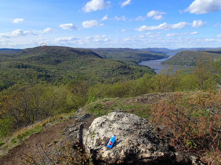
Continued on the Blue trail until it intersected with the Red (RD-Ramapo-Dunderberg) trail. From the map, RD then intersects with 77 (1777) trail. ***** I thought I would hit the Timp Pass on 77 leading back to Bear Mountain – which would turn out to be wrong! *****. At the intersection of RD and 77, I made the decision to continue on to the RD trail up to Bald Mountain. ‘I’m already here, might as well go up Bald Mountain quickly and come back at this intersection’. More views from Bald Mountain – another good view of the Perkins Tower from this summit. Took some more pictures and headed back to the RD/77 junction.
Back at the RD/77 junction, ‘Ok, just follow 1777 and at some point you’ll hit Timp Pass’, I told myself. The 1777 trail was wide and flat. ‘Hmmm, I don’t remember this in the TNF ECS BM course. I think I missed a section that would lead me to Timp Pass. Should I go back somewhere and try to find it?’. It was past 5PM at this point. It was a little late to explore so I decided to just follow the trail. The 1777 trail hits the old settlement of Doodletown. A little sight seeing on this trail, some landmarks and signs where the old homes used to be. Kept on 1777, then 77E. One last quick detour on 77E and followed the path and sound to a ‘Cascading Waterfall’, the sign says. More like a ‘Cascading Stream’, I’d say. Walked back to the trail and followed 77E to the Bear Mountain playground/parking/starting point.


It was 6PM when I finished the hike. Took my shoes off, walked on the grass barefoot. I would have taken everything off and played on the grassy playground, BUT just-add-what-you-think-if-i-have-done-this…
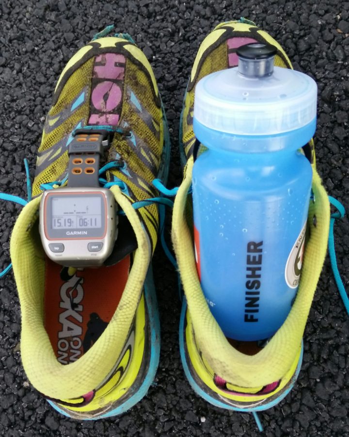
My tuna-wrap lunch became my dinner, while resting before heading home. First time exploring the BM trails done, and I really enjoyed the experience.
Post-Hike. I reviewed the trails I took, plus internet googleing, to find out how I missed the trail to Timp Pass. It was on the Blue (TT) trail, intersecting with the Red Cross (red cross on white blaze) trail. This is not marked on the map. It appears as dashed crimson trail, which the map legend describes as Unmarked Trail. I saw this intersection, but didn’t know that this was the trail to Timp Pass. Oh well, next time perhaps.
Till then.


One thought on “Exploring the Bear Mountain Trails”