More Waterfalls Hikes @ SNP

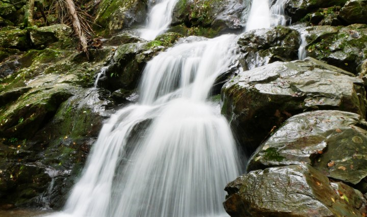
This is a series of hikes on the 2nd day of my stay @ Shenandoah National Park. These are all rated ‘moderate’ hikes from the park’s formula for determining hiking difficulty. Please bear in mind that this is relative to one’s fitness level. Also, distances listed of these hikes may not be that accurate. My GPS watch recorded longer distances for each hike. Remember to stop by the park’s Visitor Center and get up-to-date information about the trail conditions. Talk to a ranger before you go. Dark Hollow Falls.  Skyline Drive Mile 50.7.  Listed Distance RT – 1.4 miles. Rose … Continue reading More Waterfalls Hikes @ SNP

Cedar Run – Whiteoak Canyon Falls

Cedar Run – Whiteoak Canyon Circuit Hike. The official map for this circuit gives this hike a distance of 7.3 miles, with a rating of ‘very strenuous’. The distance may not be accurate. It was more than 9 miles from what I’ve read in Hiking Project and what came out of my GPS at the end of the hike. The rating was accurate, though. In a nutshell, this circuit hike starts at the Hawksbill Gap parking lot @ Skyline Drive mile 45.6, descending the Cedar Run trail until it meets the Whiteoak Canyon trail. It’s all hike up from there … Continue reading Cedar Run – Whiteoak Canyon Falls

Smoky Mountain National Park

Part of my itinerary on this weekend trip was to visit the Smoky Mountain National Park. I knew beforehand that I couldn’t hike the beautiful trails in the park after the BFC race. A scenic drive to Clingman’s Dome would be good in lieu of a hike. And of course, I needed to have my National Park Passport stamped with this visit. Saturday.  It was sunny, hot, and humid. But I was having ‘fun’ at BFC on this day. Sunday.  Remnants of hurricane Florence has now reached the inland and is now in the Tennessese area. It has been raining all day. … Continue reading Smoky Mountain National Park

Hope Pass Hike

Hope Pass.  The highest elevation in the LT100 Run Race at 12600 ft.  And you have to do it twice from both directions, on the outbound (at mile 40) and on the inbound (at mile 50).  This is where dreams die and hearts broken.  This is the crux of the LT100 race.  I hope we don’t suffer the same fate of those who failed. On Tues, Aug 14th, we hiked Hope Pass from the Winfield side, the inbound section of the LT100.  First, we drove all the way to Winfield to see where the 50th mile aid station would be.  … Continue reading Hope Pass Hike

Mt Elbert – My 1st 14er!

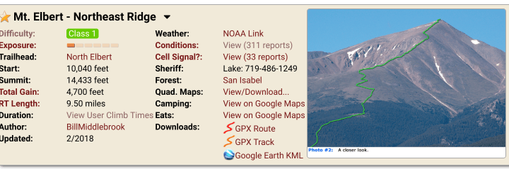
“Ok Google, What’s the highest peak in Colorado?” “Here’s what I found.  Mount Elbert @ 14,439 ft.” As part of our acclimatization period for LT 100, Philip and I needed to be exposed to high altitude, above 12k ft.  The plan was to hike 1 14er, Hope Pass, and another 12k+, on Mon, Tue, and Wed.  We checked some 14ers close to Leadville.  The shorter distance, the better, since we were after the altitude, not the mileage.  Mt Massive, the 2nd highest peak, was a good candidate.  However, looking at some pictures, this was not an easy one.  Mt Elbert … Continue reading Mt Elbert – My 1st 14er!

Exploring the Bear Mountain Trails

Sunday. May 8, 2016. 15+ miles covered exploring the Bear Mountain trails.  Ok – I didn’t really plan to cover this distance.  It just happened because I kept on intentionally making myself lost in the trails.  This was my first time exploring these trails and I only had the Avenza PDF Map App as my guide, which served me well.  The plan was to go back to Bear Mountain and re-trace the trail leading back to Timp Pass, the last steep climb in the TNF ECS BM event I did on April 30th.  I wanted to have a picture of … Continue reading Exploring the Bear Mountain Trails